Fir Snowshoe: The Bushes Whack YOU!
- Peaks: Fir
- Type: Out and Back
- Time: 7.5 h
- Distance: 8.9 mi
- Elevation Gain: 1975 ft
- Hikers: Dan, Alex, John G, Sam L
Timeline:
- 10:00 AM Leave John’s cabin
- 10:30 AM At Biscuit Brook Parking lot
- 10:40 AM Snowshoes on, hiking!
- 12:20 PM At the Biscuit Brook Lean-To
- 12:40 PM The Bushwhack begins!
- 2:55 PM Found the Fir canister
- 3:25 PM Hiking back down
- 4:50 PM back on the blazed trail
- 6:09 PM Back at the car

These are the magical ten days of the year when we have 7pm sunsets thanks to daylight savings time (March 12th) but hikes still count towards your winter peaks (until March 21st). Time to hit the trails!
Our friend John had recently moved into a cabin above Grahamsville, nestled right in the Catskills. We made plans to come over, have dinner and take advantage of the short commute to get an early start. By far the closest trailhead was Peekamoose Blue Hole, just a 15 minute drive away. It’s a little-used trailhead, but I’d been on it just last week and wanted to do something different. So we went to the Biscuit Brook trailhead instead, a 30 minute drive. It’s right next to the Frost Valley YMCA with its iconic Forstmann Castle. We’d driven past these many times on the way to other trailheads, so I was excited to see this area up close.
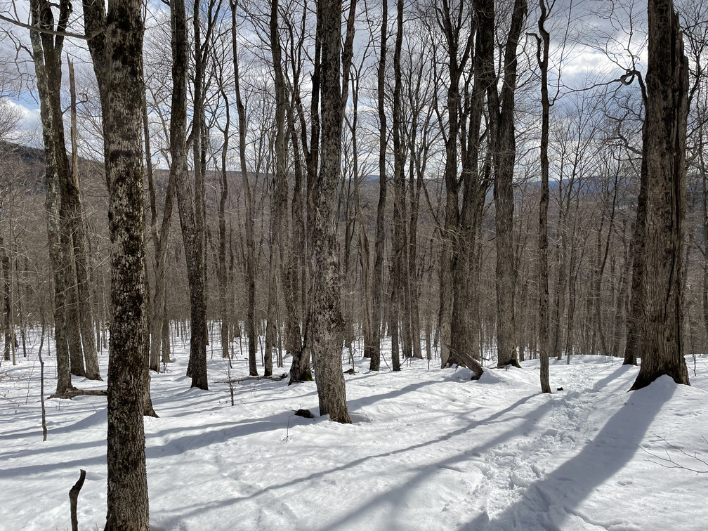
The plan was to hike Fir and Big Indian which AllTrails showed as 9.2 miles, around a third of that being off trail. After a leisurely breakfast of babka french toast, bacon and eggs, we got to the Biscuit Brook lot at 10:30 AM. Not quite an early start! We put our snowshoes on right away. We had tracks to follow for the first mile, but then they petered out and we were breaking the trail for the rest of the day. It looked like the previous hiker had been postholing. I probably would have given up, too!
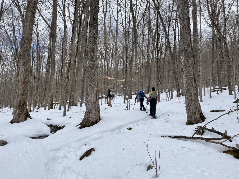
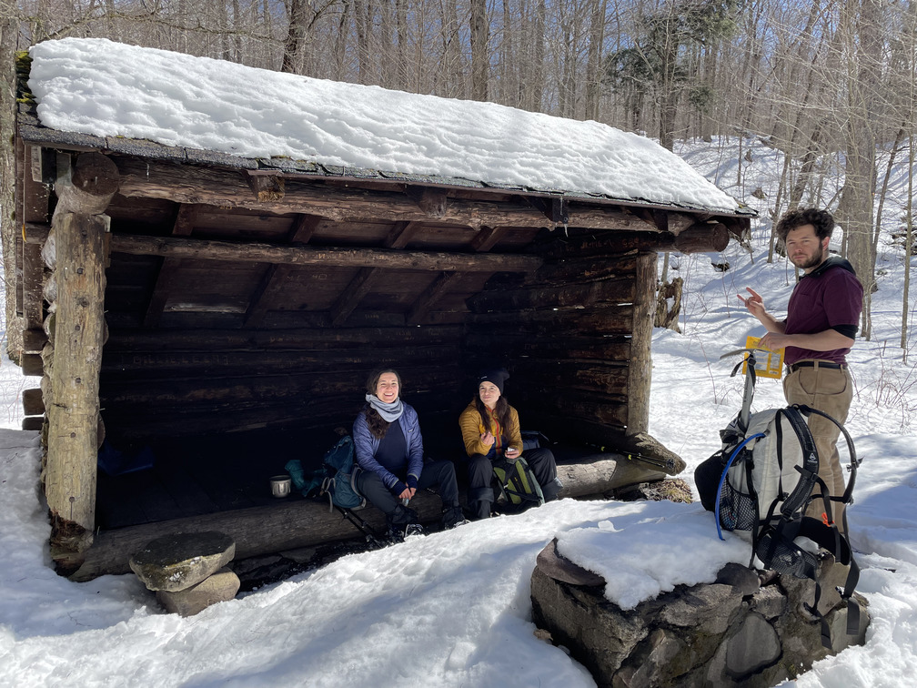
After about two hours we arrived at the Biscuit Brook Lean-To. This was an incredibly scenic snack spot. I’d love to come back in the spring or fall.
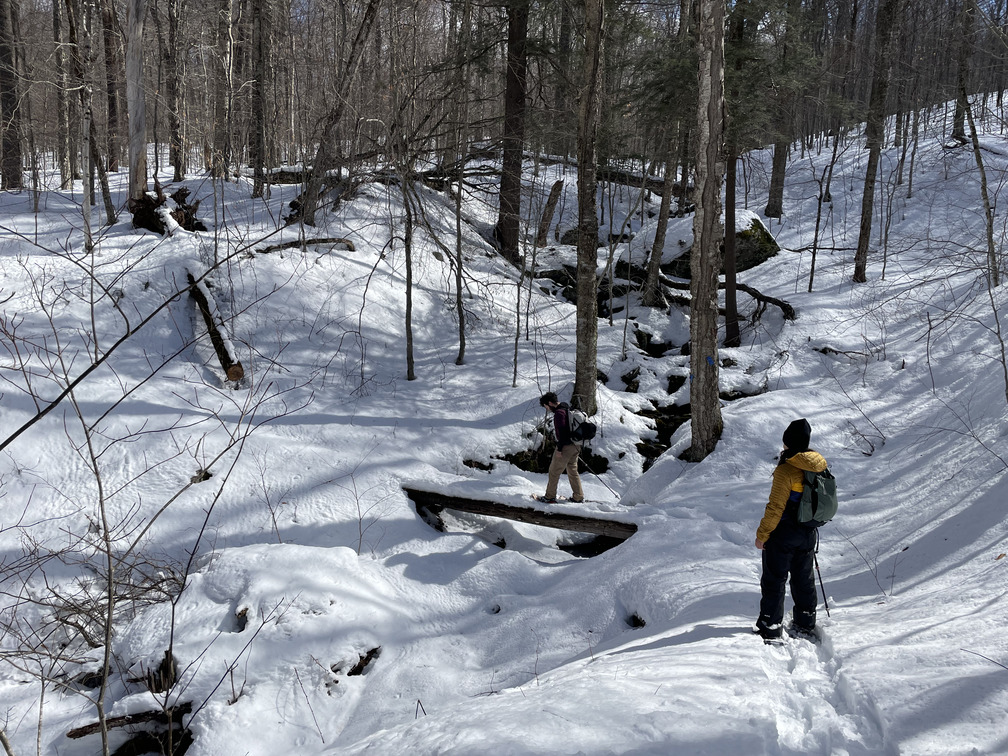
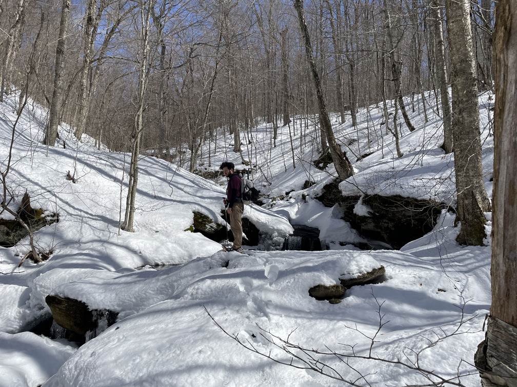
At this point the bushwhack began. We were a bit overeager to get off the trail and veered right before crossing the stream, rather than after. This meant that we had to find an alternate stream crossing and make our way up an extremely steep bank on the other side. We wound up crossing a pretty cool ice bridge. The ascent was tough, but then we were able to follow the stream at least for a little ways. Lesson learned: look more closely at objective features like “before or after a stream” on the map when you’re trying to find a trail!
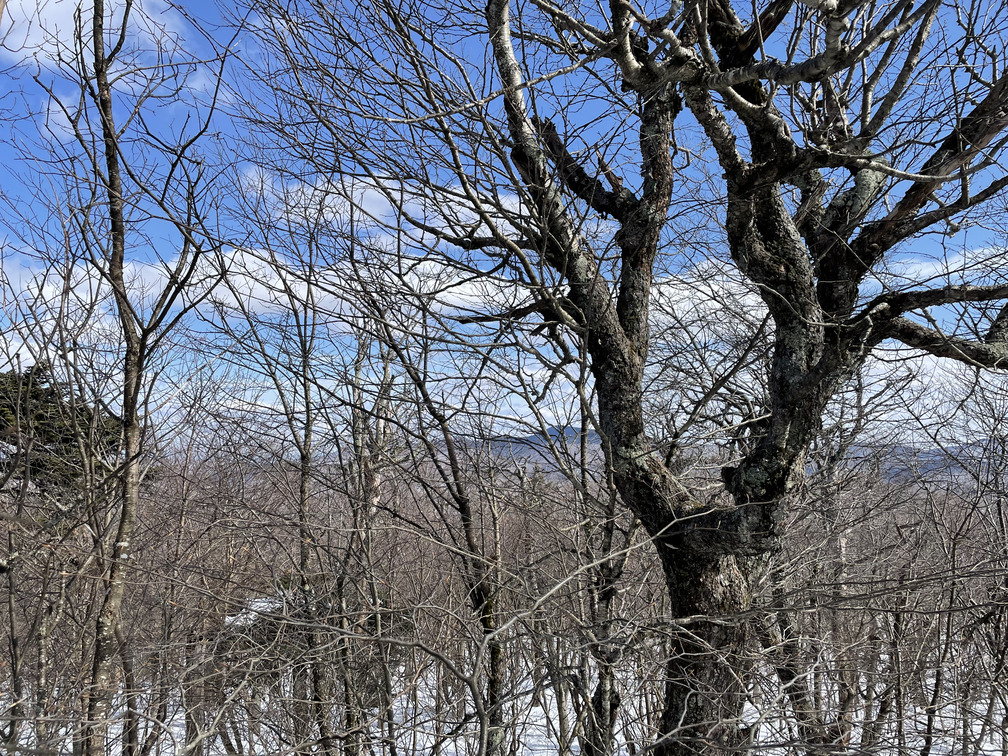
John and I alternated breaking the trail. He pointed out that you could sometimes see the herd path as a little depression, a valley in the snow. This must have been the result of it being broken after a previous snowfall and then covered again. We drifted on and off these sorts of paths most of the way up. By and large it was a gradual climb with only a few steep sections. We did rely on the GPS frequently because you could never really see the summit of Fir. I think it’s just not steep enough to make a clear profile. The trail was fairly open. There were only a few sections where we had to navigate through low branches. As Alex put it: “I thought you whacked the bushes, but really the bushes whack you!”
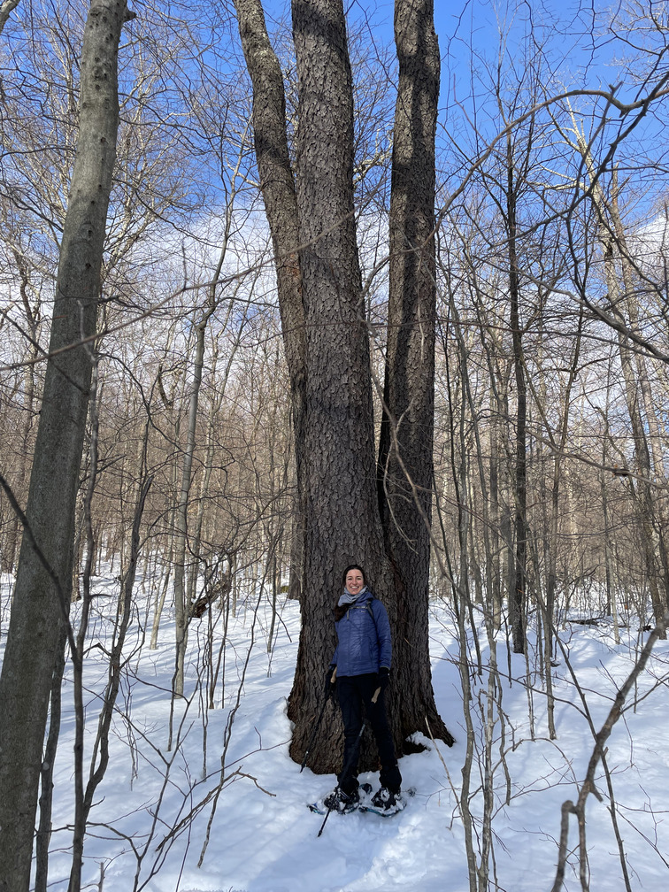
We’d recently borrowed Michael Kudish’s The Catskill Forest: A History from the Gardiner Public Library and were excited to see the first growth forests once we got above 2700ft or so. The most striking trees were enormous cherries, the largest we’d ever seen:
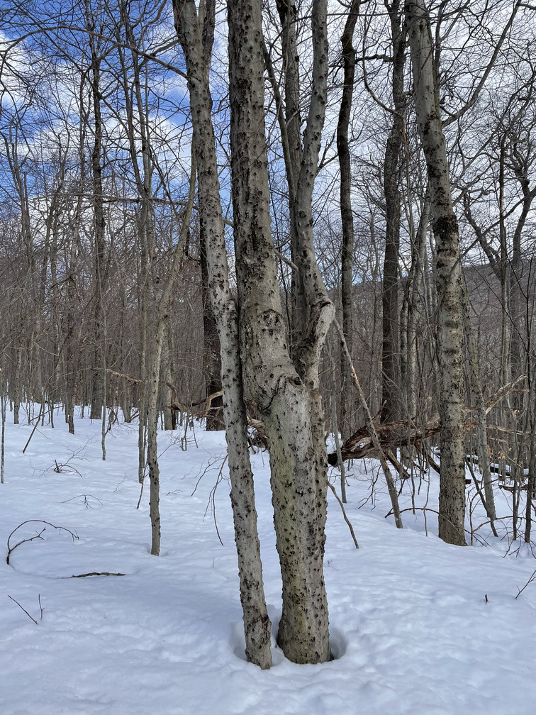
There were also many enormous birch trees and smaller beech. I love the little flecks of gold beech leaves on the snow. We saw quite a few medium-sized trees with pockmarks on them. Alex thought this might be beech bark disease.
It was a sunny day and we were working hard trudging through deep snow. I de-layered and de-layered until, by the time we neared the top, I was down to a t-shirt. There’s something so incongruous about being warm when all the scenery around you says you should be cold.
I had a scary thought that the canister and the peak icon on my map could easily be hundreds of feet from one another. I had visions of wandering around the summit. Fortunately that didn’t happen! I spied the canister on the back side of a tree only 50–100ft north of the marker on my GPS. I let out a whoop. We’d made it!
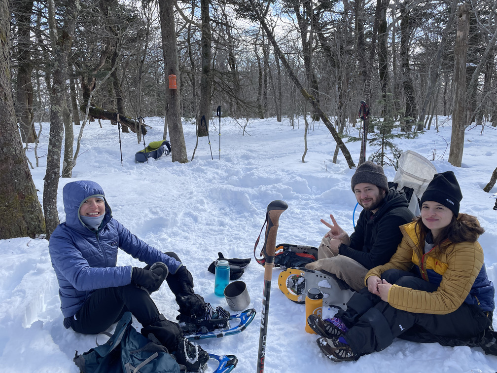
According to the canister notebook, we were the first people to summit Fir in about a week. This was Sam’s first Catskills high peak. I can’t imagine there are many people who can say that, let alone Fir in the winter!
John stamped out a sitting area at the summit and we settled down for our victory lunch: sourdough bread with peanut butter and jelly. John had lugged up some Rancho Gordo Hot Cocoa that we’d prepared at breakfast, and that was a real treat in the snow. We eat well on our hikes!
I wandered east a bit and found a few partial views of Slide, but nothing spectacular. We were struck by the height of the eponymous Fir trees at the summit. Usually the trees on summits are more stunted, but I guess Fir Mountain was neither high enough nor exposed enough to have such a strong effect.
It was almost 3:30 PM by the time we left the summit so we had no real hope or desire to get Big Indian. It would be a one peak day. I usually prefer to do loops or through hikes, rather than out and backs, but the “back” was triply nice on this hike. It was downhill instead of uphill. The trail was already broken. And we could retrace our steps instead of navigating. The 2h15m ascent only took 1h25m on the way down, just over half the time. Spirits were noticeably higher. We had some snowball fights and slid down a few of the steeper sections.
We corrected our mistake from the morning and came back to the blazed blue trail on the north side of the stream. It was less steep than what we’d done before, but the stream crossing wasn’t any easier.
The hike back was a bit of a slog, especially where the trail turns to avoid YMCA property. The more natural path would be for the trail to follow the ridge towards the Forstmann Castle and have the parking lot there, but I guess that’s not state land. The snow had melted considerably since we’d been over this part of the path in the morning. There were many more exposed rocks. I can see why this trailhead doesn’t get much use: it’s far from any trailed peaks and, unless you’re going to the Lean-To, there are better places to start.
Overall this was a great hike! I was happy to spend a good chunk of time navigating the bushwhack and to find the canister. I was also happy with my equipment setup and clothing layers. I’d bought new boots a week ago and they stayed dry all day. It would have been nice to get Big Indian as well as Fir, but that just wasn’t in the cards. Fir is a tough one, and crossing it off the list simplifies my task in closing out the 3500 this spring.