Plateau from Notch Inn: A Gamble with the Weather Pays Off
- Peaks: Plateau
- Type: Loop
- Time: 4.8 h
- Distance: 9.4 mi
- Elevation Gain: 2300 ft
- Hikers: Dan (solo)
Timeline:
- 12:30 PM Start hiking
- 2:10 PM First viewpoint
- 2:20 PM At 3500ft (the spring)
- 2:40 PM On the Devil’s Path
- 2:50 PM Summit Plateau and see the Bicknell’s Thrush
- 3:55 PM At Orchard Point viewpoint; begin descent
- 4:50 PM On SR 214 at Devil’s Tombstone Campground
-
5:20 PM Back at the car
- Tracks: AllTrails, eBird
- Conditions: Damp, sometimes rainy, slightly muddy, changing to sunny by the end of the hike.

When I applied to join the 3500 Club, I received a nice welcome letter from David White, membership chairman. It summarized my hiking over the past few years (he’d clearly read this blog!) and offered a few suggestions. One of those was to hike Plateau from Notch Inn Rd instead of Mink Hollow as Alex and I did last fall.
I was also interested in Plateau because last week Jim Bouton had told us about seeing the elusive Bicknell’s Thrush there. This bird only breeds above 3500 ft in the summer and is the unofficial mascot of the 3500 club.
Alex had an event in the city today. If I wanted the car, I’d have to drop her off at the New Paltz park and ride just after 11 AM and pick her up just after 7 PM. The Park & Ride is conveniently close to the highway and about a third of the way to the Catskills. A perfect opportunity for a day hike!
Or at least it would have been had the weather cooperated. The forecast was iffy with a 50% chance of afternoon thunderstorms. It got even iffier as I approached the trailhead: I got rained on several times and started to wonder whether this would all just be a waste of time. I noticed that some blue skies were visible, though, and that I could see the tops of the mountains. I knew from our last hike that this might turn out OK. I don’t mind getting a little wet, but it would be a shame to miss spectacular views by hiking in a cloud like we did on Black Dome a few years back.
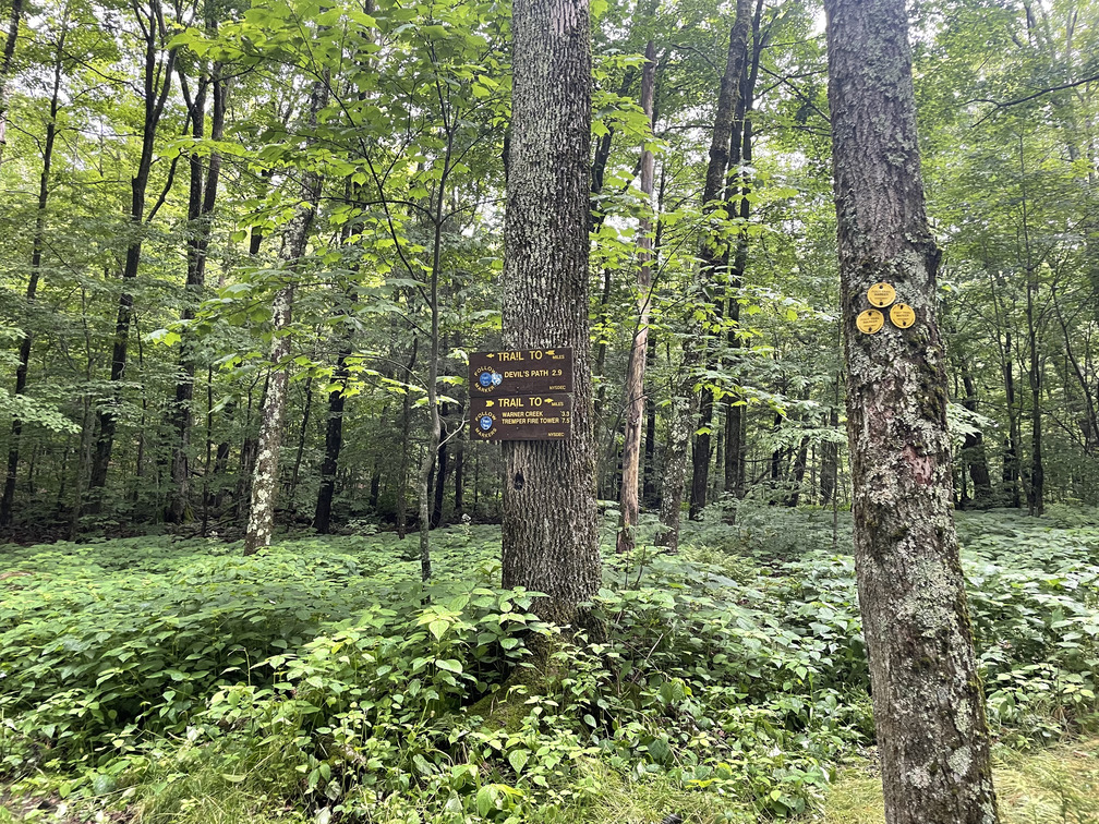
The parking situation on Notch Inn Rd was unclear. There was a pulloff right by the main highway, but this wasn’t where the “P” was on my map. I drove higher up the hill only to see this sign:
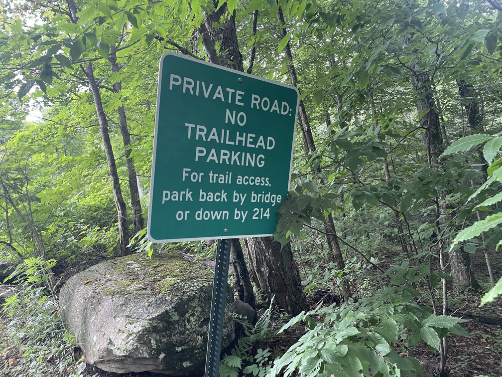
So I’d be hiking from the road after all. I planned to do a loop, so it was really the same either way.
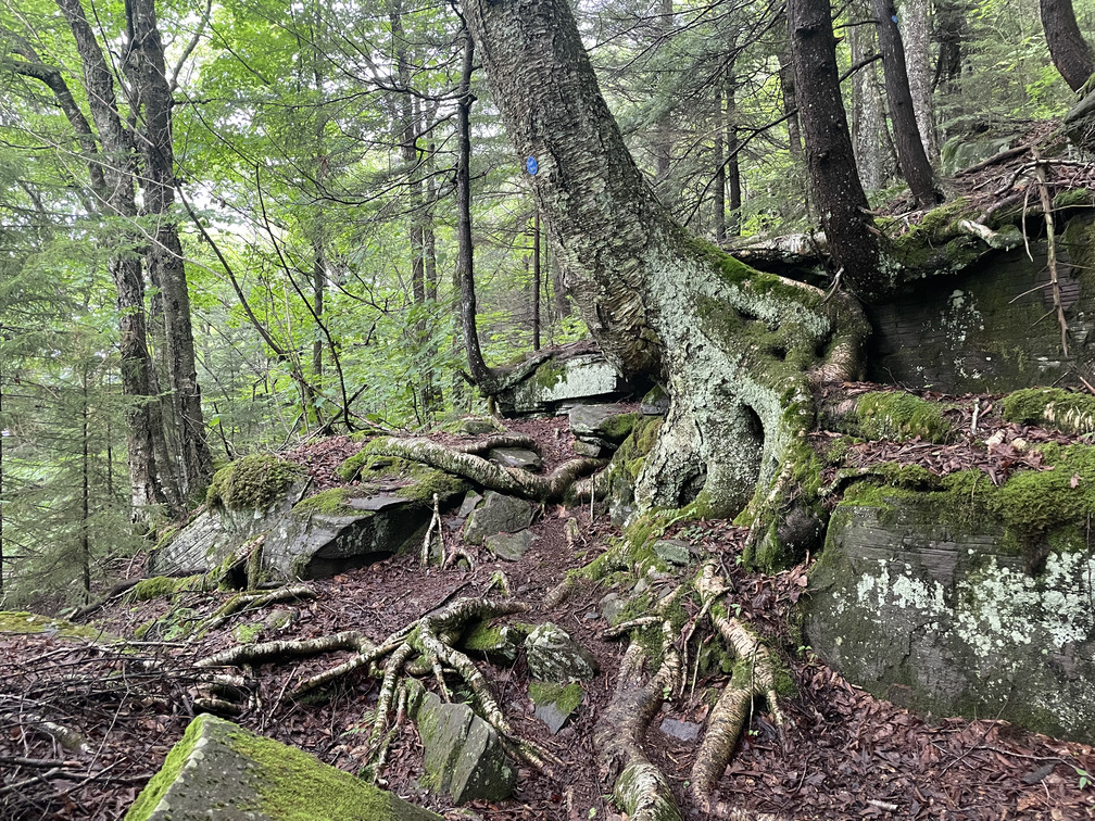
Near the top of Notch Inn Rd it looked like I’d be walking straight into someone’s driveway. Looking at the map and getting my orientation, I realized that this overgrown gap must be the trail:
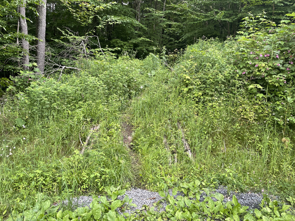
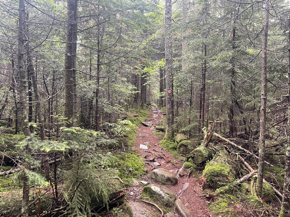
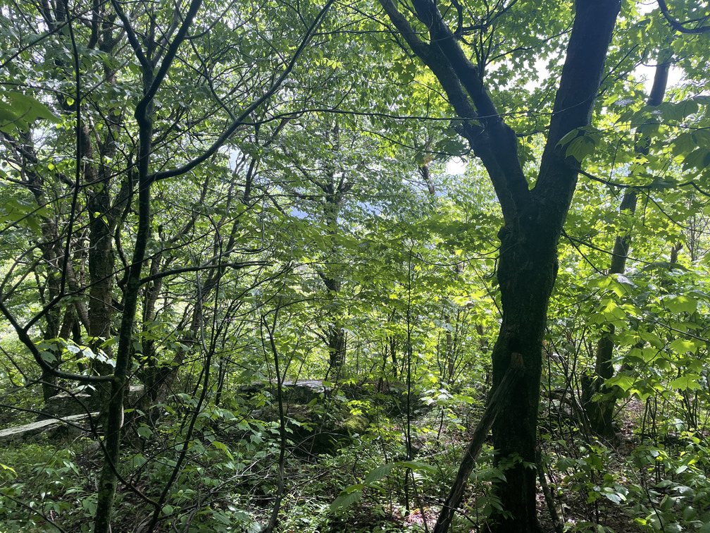
Not an inviting entrance, but as soon as I crossed it I was in another world on a clearly blazed yellow trail.
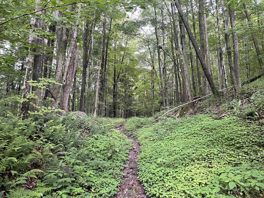
At some point in the first mile I could tell that it was raining, but nothing made its way down to me from the tree canopy high overhead. Once I’d hiked a mile or two, I was committed: I was doing this hike, whatever the weather at the summit!
It was a novel feeling to be hiking entirely at my own pace, stopping only when I wanted to. I realized that this was the first time I was solo hiking on blazed trails since 2020. I was curious what my natural pace would be having hiked so much in the past year.
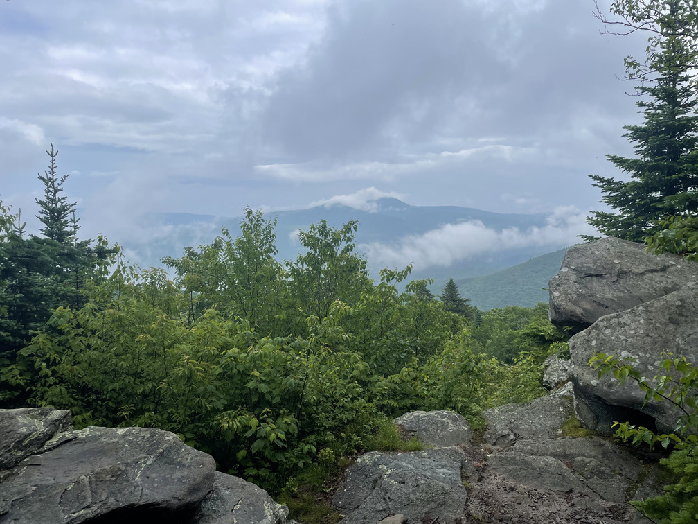
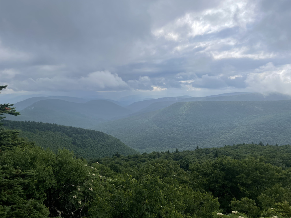
After a little over an hour and a half I arrived at the first overlook and my concerns about missing out on the views were swept away. This was spectacular!
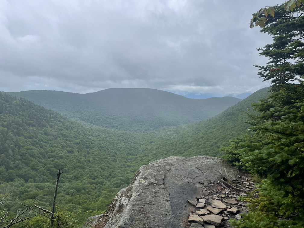
I really liked this view from a rocky perch with absolutely no sign of human habitation. I was happy with my ~2mph pace and it wasn’t raining, so I took a few minutes to enjoy the first part of my lunch.
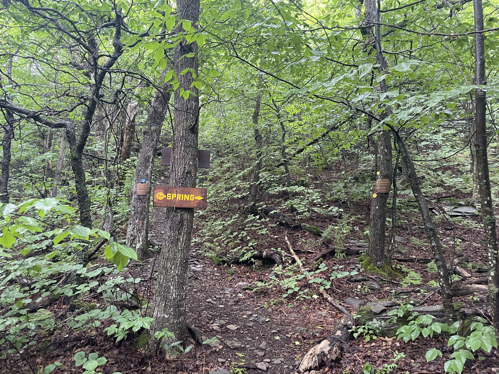
Very soon after this I arrived at the 3500 ft level and a spring. After experiencing the Panther spring as just a trickle last week, it was nice to see this one gushing. (We’ve had at least three inches of rain in the past week.) I played the Bicknell’s call and song on my phone to familiarize myself with it, but there was no response.
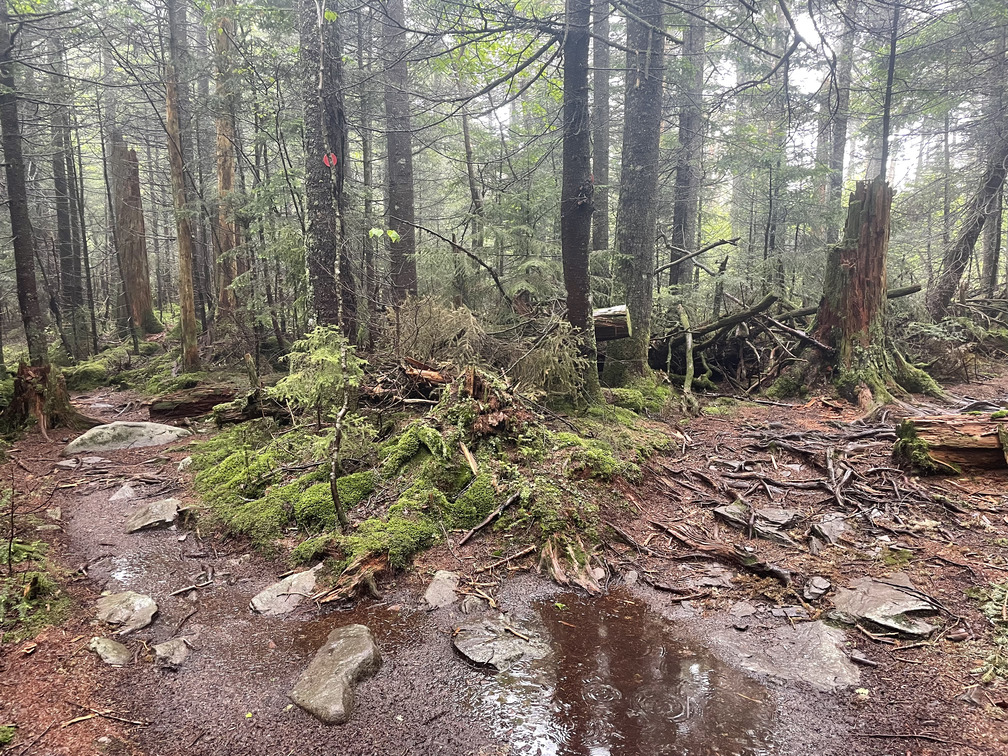
Twenty minutes later I was up to the Devil’s Path and the long summit plateau of Plateau Mountain. By this point I was in thick, stunted Fir and the low canopy did little to block the rain. I was really in it!
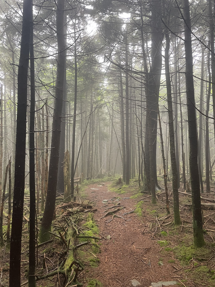
It was only a half mile detour to the summit of Plateau and it was quick hiking on flat terrain. It was still raining when I got there so I didn’t want to linger. But the habitat did look just right for the Bicknell’s (extremely thick forest) so I figured I’d try playing its call.
I immediately saw a gray bird fly by. I couldn’t get it in my binoculars as it flitted through the thick forest, but it did eventually start making a chip call that Merlin confirmed as the Bicknell’s. I was happy to see this bird in the Catskills! (Alex and I had already seen one in the Adirondacks a few years back.) On the hike back towards Orchard Point I heard two more Bicknell’s singing a duet back and forth over the path. This was good because it meant I could code them as “Singing Birds Present 7+ Days” for the Breeding Bird Atlas (some other hikers had posted on Facebook about hearing them over a week earlier).
The walk to Orchard Point was slow-going, not because of the terrain or the weather but because there were so many interesting birds! I saw a baby Dark-eyed Junco getting fed by dad. I heard Blackpoll Warblers, saw a Brown Creeper, heard Golden-crowned Kinglets, Magnolia Warblers, Yellow-rumped Warblers, Winter Wrens and a Purple Finch.
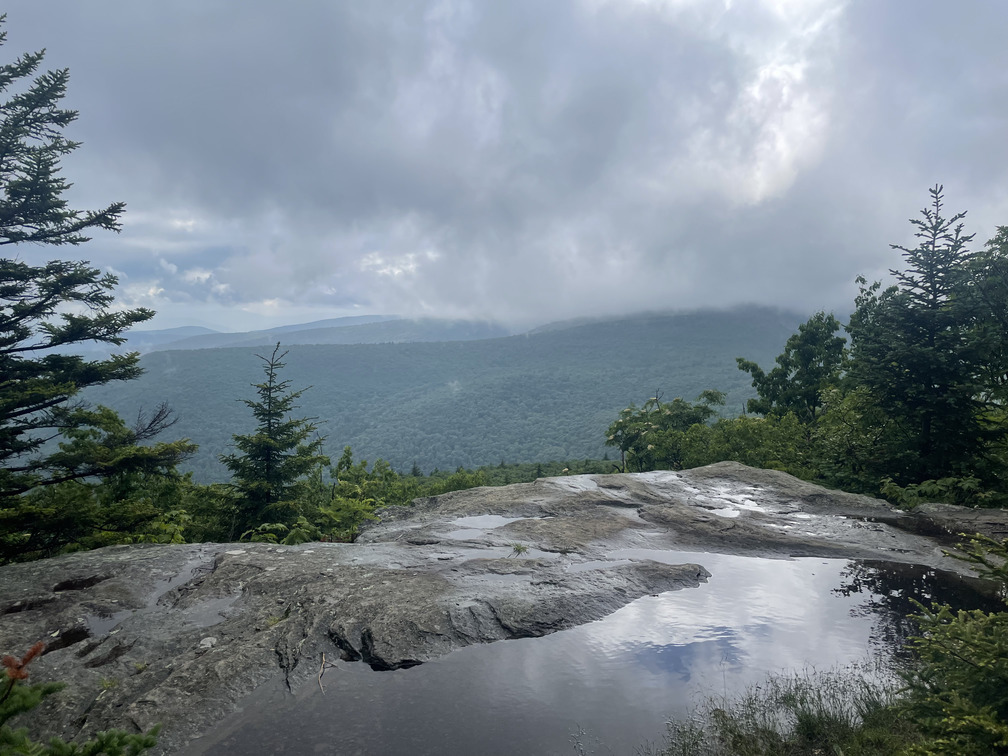
By the time I got to Orchard Point the weather was starting to clear up and the views were truly spectacular. I liked seeing the giant puddle on the viewpoint ledge, and the layers of mountains going off into the distance. So long as you’re not in the middle of a cloud, the weather can make for really atmospheric views.
The descent from Orchard Point back to the highway was extremely steep and probably my least favorite part of this hike. At points it was very muddy and I was worried about slipping on the wet rocks on steep slopes. I took it slow, stepped carefully, used my hiking poles to brace myself and never felt terribly insecure. Soon enough I heard a waterfall and cars and knew I was close.
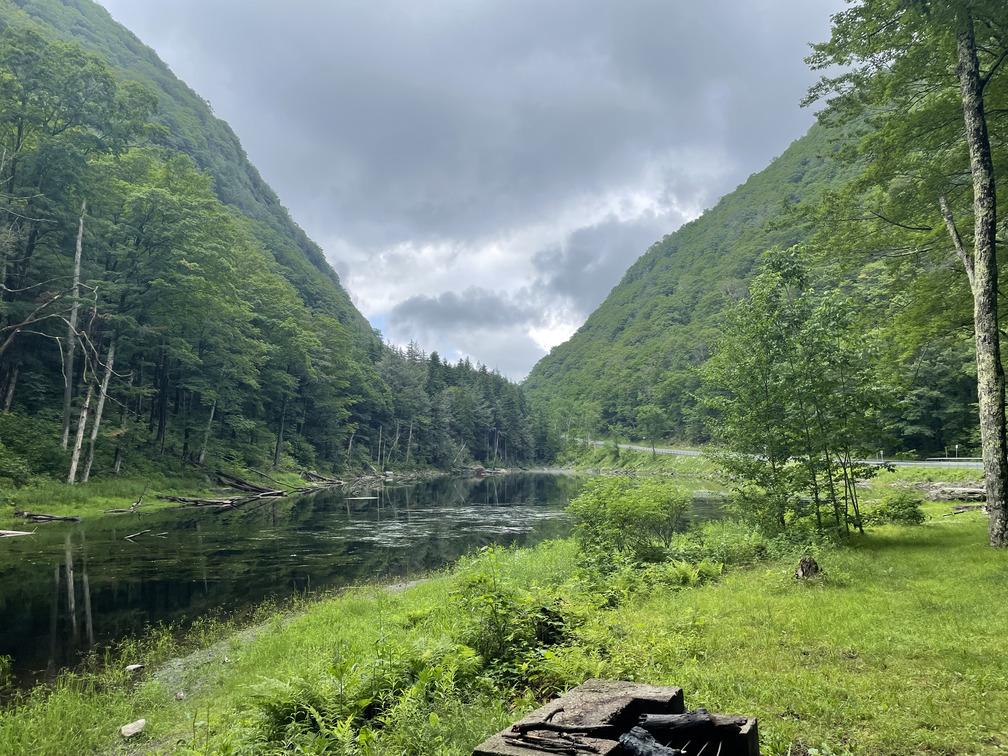
All of 100 ft from the trail register I saw the first other hikers of the day, a pair heading up to Plateau in the afternoon. They probably timed the weather better than I did. I’d never been to Devil’s Tombstone before but I’d certainly seen it on maps. The view of the Stony Clove Notch from Picnic Lake was incredible. It looked like it belonged in the Adirondacks with those steep ridges.
I don’t love hiking on highways so I wasn’t looking forward to the 1.5 miles back to the car. But this turned out to be an interesting hike! I thought I saw a Groundhog by the side of the road, only to realize it was a Beaver doing some maintenance on its dam!
I also heard a Wood Thrush and a Veery on my walk. That made it six thrush species for the day: Hermit Thrush, Swainson’s Thrush, Bicknell’s Thrush, Wood Thrush, Veery and American Robin. (Alex pointed out later that I’d only missed one: the Eastern Bluebird.)
Soon I was back at the car and another hike was in the books. My overall pace including breaks was just below 2mph, much faster than the 1mph we did while working on the Breeding Bird Atlas last week!
I had some time to kill before picking Alex up so I drove over to Phoenicia for a snack. I observed one more mammal on the drive: a bear rummaging through some trash on the side of the road!