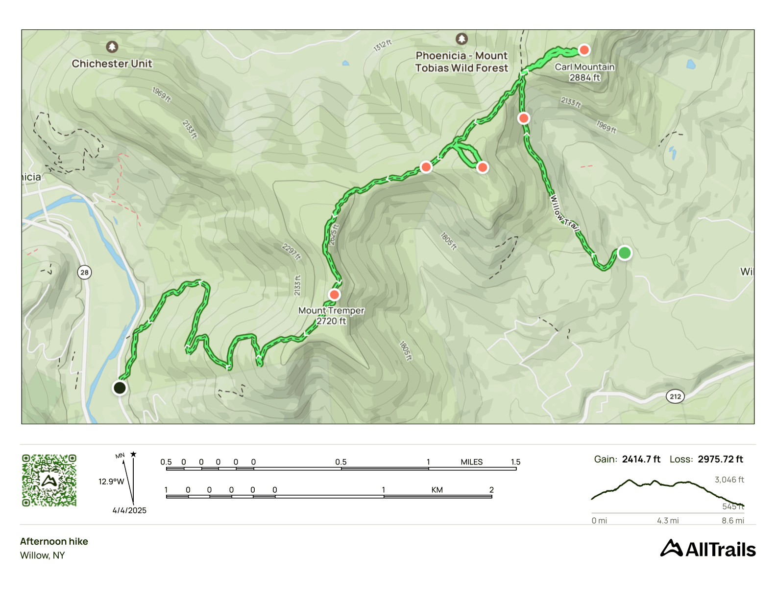
Carl Mountain, Hoyt Hollow, Mt. Tremper
- Peaks: Carl, Hoyt Hollow, Mt. Tremper
- Type: Through (car shuttle)
- Time: 5 h
- Distance: 8.5 mi
- Elevation Gain: 2415 ft
- Hikers: Dan
Timeline:
- 9:00 AM Start hiking from Jessup Road
- 10:20 AM Summit Carl (40m side track)
- 11:15 AM Summit Hoyt Hollow (25-30m side track)
- 12:20 PM Tremper Fire Tower
-
2:00 PM Back at stashed car on Plank Road
- Tracks: AllTrails, eBird 1, eBird 2
- Conditions: Cool and cloudy in the morning, sunny and warm (50s) in the afternoon. No ice or snow anywhere.
After completing my winter peaks (I’m 3500 Club Winter #1688), I needed a new project. What’s the point of hiking, after all, if you don’t have a spreadsheet of peaks to tick off!?
I’m interested in the Four Seasons. I’m interested in the Adirondacks. I’m not interested in The Grid. But after hiking Sleeping Lion in February, I learned about another list: The Catskills Hundred Highest (CHH). I knew about the Catskills 67, but many of those are on private land, which put me off. But there’s a variant called the C100PP (Catskill Hundred Highest on Public Property) that doesn’t have this problem.
Having a new list was exciting! I’ve made extensive use of my hike planning tool over the past few years, and I was curious to see what it came up with for the C100PP. It’s still a work in progress, but there was one three-peak through hike that stood out:
I’d driven past signs for Mt. Tremper many, many times but never hiked it since it wasn’t a 3500 foot peak. One of the trailheads is right next to Phoenicia, where Alex would be doing her annual at Menla. Seemed like a perfect reason to do visit a famous Catskills firetower!
I also signed up for a 3500 Club hike (The Six) for Saturday, which would have helped me with the Four Seasons. But it got rained out. The weather looked perfect for today, though, so I decided to try the Carl Mountain / Hoyt Hollow / Mt. Tremper combo.
What gear to bring? I’d checked the Catskills Trail Conditions group and it seemed like there was only a little snow and ice left above 3,700ft. Since I’d be staying below 3,000 ft, I elected to leave my spikes in the car. This was a good decision. There was no snow or ice anywhere on this hike.
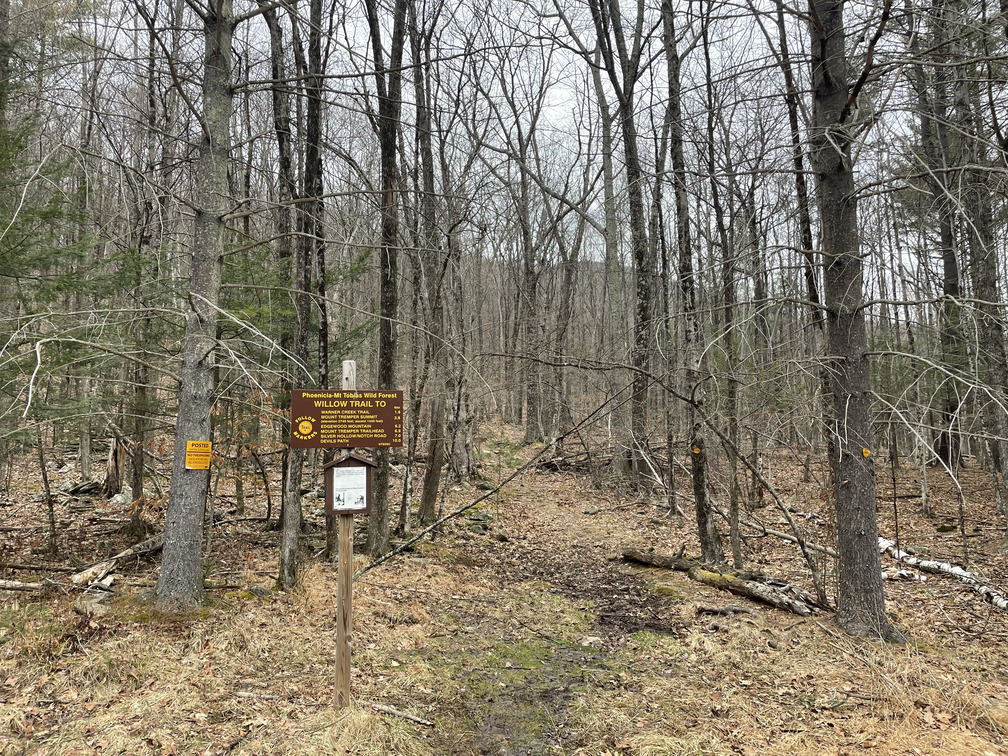
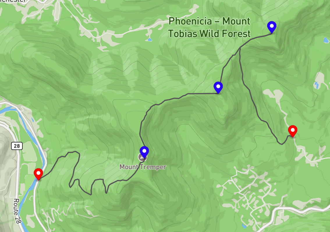
Alex and I drove to the Plank Road trailhead and stashed a car. We were the first ones there. Then she drove me to the Willow / Jessup Road trailhead. There were some ominous signs about private property here, but there were also clear signs for Forest Preserve parking. The road got a little rough before the lot and we wished we were in our RAV4 instead of our Ioniq. But Alex managed to make it up and dropped me off before racing off to her yoga retreat at Menla.
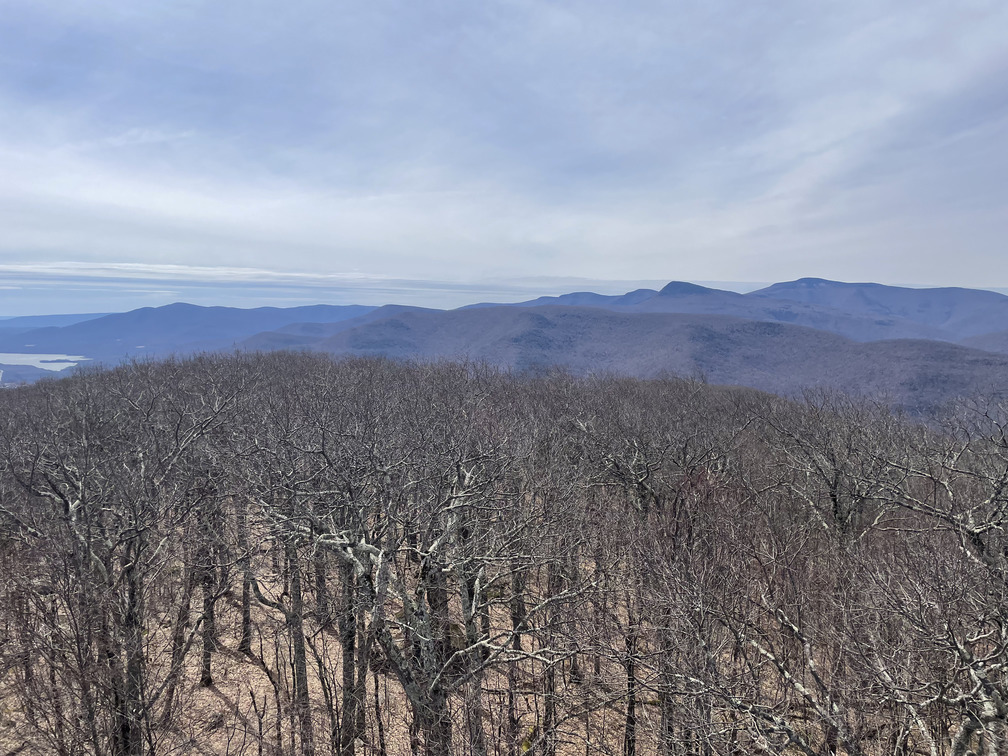
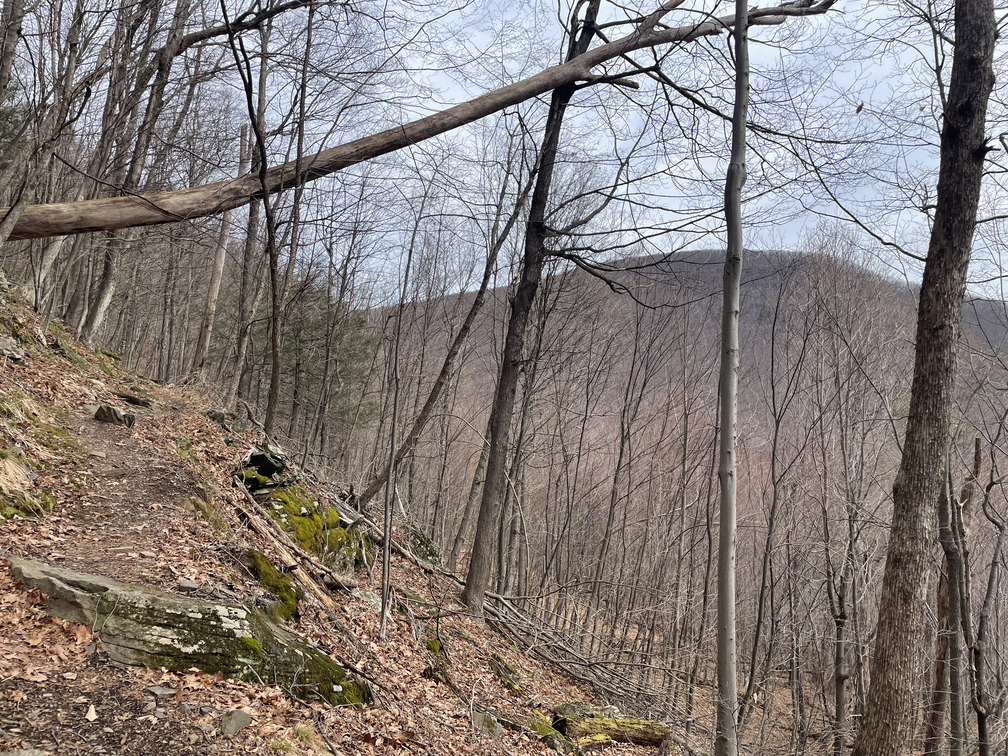
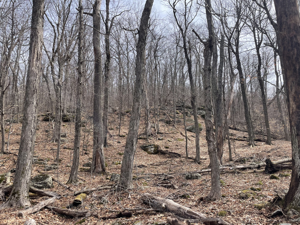
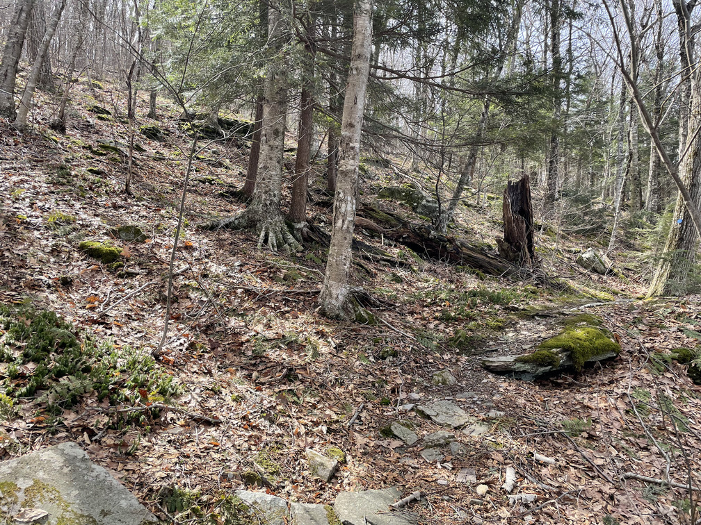
I was a bit cool at the start of the hike, but I warmed up quickly as I ascended and soon my jacket and gloves came off. I passed under some cliffs below Hoyt Hollow, which I’d be summitting later. There were lots of seasonal views on the hike up, and a good view of Carl Mountain, my first bushwhack.
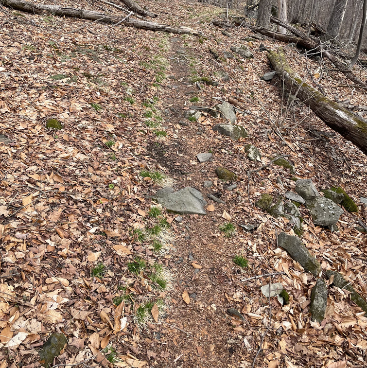
This is the third year in a row that I’ve hiked this weekend, and it’s always striking how much changes in a few weeks. It really felt like early spring. I was hiking on dirt, but there were no leaves or flowers anywhere. The only signs of life were some exuberant mosses and green sedge grass growing in around the dried out remains from last year.
There was also lots of bird activity! I heard a woodpecker drumming and a Winter Wren singing. There were countless Dark-eyed Juncos singing, and I even saw a Golden-crowned Kinglet!
When I hit the col, I was greeted by a cool wind coming from the north. I went right on the blue trail. I planned to hike a quarter mile down the trail before cutting in to start the bushwhack, but the woods looked open and inviting where I was, so I started closer to the col.
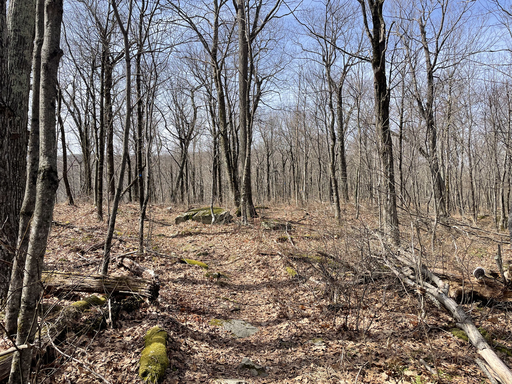
This bushwhack was slower going than I expected, but all around not too terrible. I had one “what am I doing?” moment when I saw some bear scat and had to navigate around some ledges. The brush got denser as I got closer to the summit, but it was never difficult to get through. I experienced the “receding summit” effect, where you keep thinking you see the summit on the horizon, only to see a slightly higher one once you get there.
After about 20 minutes I was at the summit, and I was pleased to see that it was marked by a large cairn.
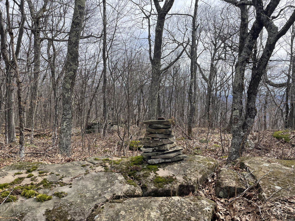
This really made the bushwhack worth it to me. There’s something magical about suddenly feeling the presence of other people in a place that’s otherwise unmarked by humans. I imagine this is what some of the 3500 Club canisters felt like 30 years ago, before the herd paths emerged.
I intended to cut a more direct line back to the trail on my way down. But I followed the contours of the landscape, not my map, and when I hit the trail I was exactly where I’d cut in before!
The next peak was Hoyt Hollow. I hiked southwest along the blue trail and kept wanting to cut into the woods and start my bushwhack. But I forced myself to wait unitl my map said I was at the closest point. This was much farther along than I expected. It would have been very hard to pick out the true summit from the trail below.
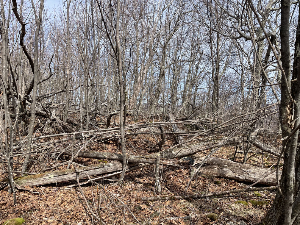
This bushwhack was considerably shorter, though a bit steeper. There were many downed trees near the summit which made it hard to get around. It wasn’t clear to me where the true peak was. I spotted a boulder that looked promising and made my way over to that. From the boulder, I could tell that the summit pin I had on my map was lower down. But there was a bit of land that might be higher in the opposite direction. It was completely surrounded by downed trees.
When I walked over, there was the cairn!
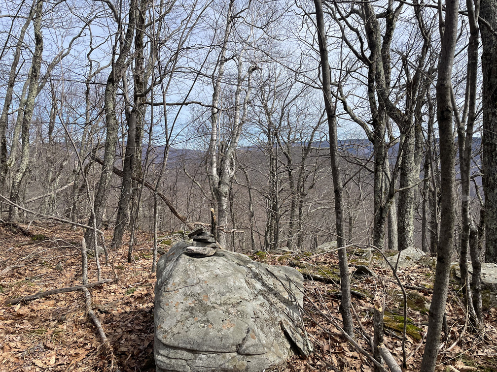
The view here was pretty nice and I took a moment to enjoy it. For the hike down, I used my phone to set a direction and kept with it. Once again, I wound up just a few feet from where I’d started the bushwhack.
The ridge hike over to Mt. Tremper was beautiful, with seasonal views in both directions. I ran into a couple walking the other direction, the first people I’d seen on the hike. There were enormous numbers of Dark-eyed Juncos and woodpeckers along this section of trail.
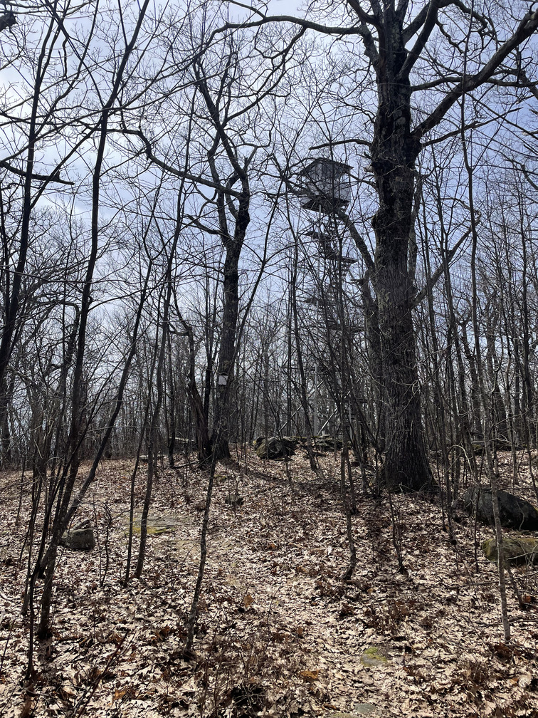
The Tremper fire tower really snuck up on me. But there it was! No doubt about this summit. I saw a sign at the fire tower worried that it was closed. But no, it just said no more than six people could be in it at any time. That wouldn’t be a problem today!
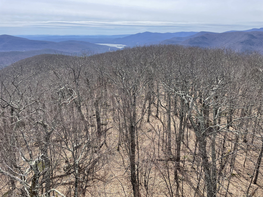
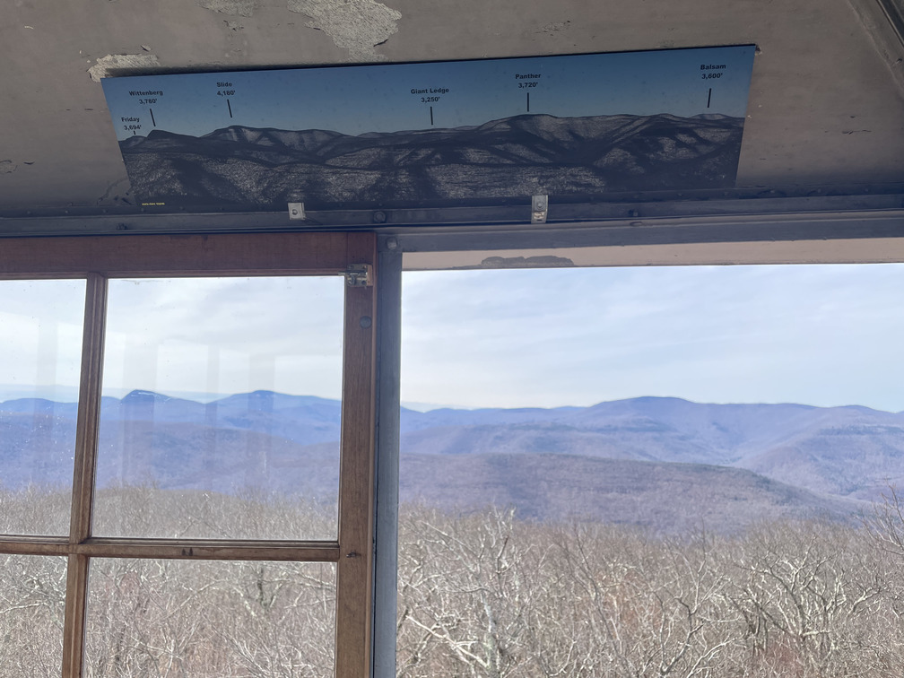
The views from the fire tower were spectacular. I liked the design, with glass windows that you could unlatch and open up for unimpeded views. I also appreciated the photograph with a key showing which mountain was which. From the fire tower, I could see that there was just a bit of snow left on the east face of Slide, as well as the man-made snow at Hunter.
For the descent, I was on the more popular red-blazed Phoenicia Tremper trail. After seeing only two people all morning on the Willow trail, I passed no fewer than 15 people on my way down! I guess I just beat the rush. Two of the hikers were planning to camp at the lean-to and were a bit worried about the weather tomorrow.
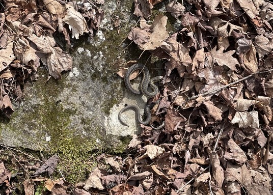
This descent had a lot of switchbacks, which meant that it was relatively long (~3mi) for the distance that it covered, but it was at least not too steep. I saw a Dark-eyed Junco perched on a branch, “singing its little heart out.” It’s so easy to spot birds without leaves on the trees! I also saw my first snake of the season. Alex and I decided later that it was a small garter snake.
When I finally made it to the end, there were seven cars in the little Plank Road lot. I was happy to have a mere five minute drive back to Phoenicia Lodge!
So I’ve gone from 40→43 peaks on the C100PP list. That’s progress! I don’t know how seriously I’ll pursue this, but it’s at least fun to have a goal.